


Precinct 2, Roosevelt County, Montana
About
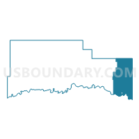
Outline

Summary
| Unique Area Identifier | 612257 |
| Name | Precinct 2 |
| County | Roosevelt County |
| State | Montana |
| Area (square miles) | 290.67 |
| Land Area (square miles) | 288.01 |
| Water Area (square miles) | 2.66 |
| % of Land Area | 99.09 |
| % of Water Area | 0.91 |
| Latitude of the Internal Point | 48.22238640 |
| Longtitude of the Internal Point | -104.14306660 |
Maps


Graphs
Select a template below for downloading or customizing gragh for Precinct 2, Roosevelt County, Montana


Neighbors
Neighoring Voting District (by Name) Neighboring Voting District on the Map
- McKenzie 39-07 Voting District, McKenzie County, ND
- Precinct 10, Roosevelt County, MT
- Precinct 12, Roosevelt County, MT
- Precinct 2, Sheridan County, MT
- Williams 2-45 Voting District, Williams County, ND
- Williams 2-55 Voting District, Williams County, ND
- Williams 2-67 Voting District, Williams County, ND
Top 10 Neighboring County Subdivision (by Population) Neighboring County Subdivision on the Map
- East Roosevelt CCD, Roosevelt County, MT (1,578)
- Fairview CCD, Richland County, MT (1,476)
- Medicine Lake CCD, Sheridan County, MT (592)
- Yellowstone township, McKenzie County, ND (417)
- Round Prairie township, Williams County, ND (118)
- Hardscrabble township, Williams County, ND (86)
- Buford township, Williams County, ND (74)
- Hebron township, Williams County, ND (34)
- Strandahl township, Williams County, ND (20)
- Bull Butte township, Williams County, ND (13)
Top 10 Neighboring Place (by Population) Neighboring Place on the Map
Top 10 Neighboring Elementary School District (by Population) Neighboring Elementary School District on the Map
- New Public School District 8, ND (2,362)
- Fairview Elementary School District, MT (1,321)
- Culbertson Elementary School District, MT (1,022)
- Yellowstone Public School District 14, ND (525)
- Froid Elementary School District, MT (430)
Top 10 Neighboring Secondary School District (by Population) Neighboring Secondary School District on the Map
- Fairview High School District, MT (1,401)
- Culbertson High School District, MT (917)
- Froid High School District, MT (430)
Top 10 Neighboring Unified School District (by Population) Neighboring Unified School District on the Map
- Eightmile Public School District 6, ND (660)
- Grenora Public School District 99, ND (652)
- Medicine Lake K-12 Schools, MT (620)
- Bainville K-12 Schools, MT (364)
Top 10 Neighboring State Legislative District Lower Chamber (by Population) Neighboring State Legislative District Lower Chamber on the Map
- State House District 2, ND (13,822)
- State House District 39, ND (13,645)
- State House District 36, MT (8,070)
Top 10 Neighboring State Legislative District Upper Chamber (by Population) Neighboring State Legislative District Upper Chamber on the Map
- State Senate District 18, MT (17,057)
- State Senate District 2, ND (13,822)
- State Senate District 39, ND (13,645)
Top 10 Neighboring 111th Congressional District (by Population) Neighboring 111th Congressional District on the Map
Top 10 Neighboring Census Tract (by Population) Neighboring Census Tract on the Map
- Census Tract 9535, Williams County, ND (1,676)
- Census Tract 801, Roosevelt County, MT (1,578)
- Census Tract 701, Richland County, MT (1,476)
- Census Tract 9625, McKenzie County, ND (1,308)
- Census Tract 904, Sheridan County, MT (1,006)
Top 10 Neighboring 5-Digit ZIP Code Tabulation Area (by Population) Neighboring 5-Digit ZIP Code Tabulation Area on the Map
- 58801, ND (18,371)
- 59221, MT (1,658)
- 59218, MT (927)
- 59226, MT (410)
- 59212, MT (373)
- 59219, MT (199)